
------------------------------------------------------------------------------------------------------------------------------------------------------
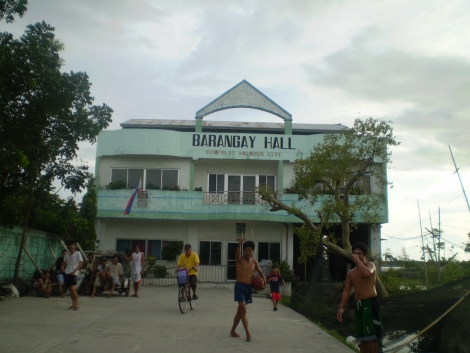 |
DAMPALIT MALABON CITY |
------------------------------------------------------------------------------------------------------------------------------------------------------ HISTORY
OF DAMPALIT
The northern part of Malabon has been called Dampalit, eversince it became
a Barrio. People believe that this name might have been derived from
either the Tagalog term : DAANG-PALIIT or
MADAHONG PALIIT.
MADAHONG-PALIIT contracted into DAMPALIT, was
a kind of vegetable plant that grew plentifully in the place, especially
in the fishponds. Since the abundance of this plant distinguishes it from
other places, Dampalit might have been the name given to the barrio.
On the other hand, some people believe that Dampalit came from
DAANG-PALIIT meaning a street which tapers towards the end. In
this barrio, there is only one street which narrows down to a width of one
foot at its end. This might have been the reason why the barrio was called
DAMPALIT.
Barangay Dampalit occupies about 16.6 % of the entire locality.
Fishpond operations remain the line of business despite the present
stature of Malabon which is fast becoming an industrial and commercial
community.
DEMOGRAPHICS
A. Census
a.
Population : 11,165 ( based on NSO Official count CY2000 )
Population : 11,402 ( based on BHW
survey CY2007 )
Population : 12,087 (based on BHW survey CY 2008 )
b. Population Growth Rate: 1.92 (of Malabon)
c. Population Density : 42.63
(person/hectare)
d. Total Number of Households : 2,489 ( NSO
Official count CY2000 )
e. Total Land Area : 261.90 hectares (
16.67% of Malabon )
B. Voting Populace
a. Number of Registered Voters 6213 ( based on
2007 Election )
b. Number of Polling Precints 31 ( based on
2007 Election )
C. Barangay Map & Boundary
North: Bulacan Province
South: Barangay Muzon, Malabon City
East: Obando, Bulacan
West: Hulong Duhat, Malabon City & Navotas City
(download
- copy of Barangay Maps)
